Hi everyone,
This is not really a question, but rather something I had needed for some time, did some research and for which I eventually came up with an excel-based solution.
In work I came across the problem of having to calculate work loads for several work groups, based on the geographical location of the places they needed to go. For that, I needed to know which points were inside which polygons.
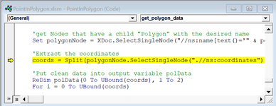
I made a workbook which can test whether a point(s) is inside a polygon(s). This solution does not need any online "KML" generators or file interpreters. All you need is Excel and your KML file with the polygons.
Thanks to Rick Rothstein and user sijpie, who got me on the right track with this thread:
http://www.mrexcel.com/forum/excel-...lygon-visual-basic-applications-function.html
INSTRUCTIONS:
1. Download the workbook here: https://www.dropbox.com/s/707qslttz428v6w/PointInPolygon.xlsm?dl=0
2. In Google Earth, draw all the polygons you want to test. Put them all in the same folder.
3. Right-click the folder and click "Save As". Save it in the same directory as the Excel file, with the name "Polygons". Choose the format .kml (very important!)
4. Put all the coordinates you want to test on the columns B and C on the first and only sheet in the workbook. Coordinates must be in decimal format, like this: 40.689397 and -74.045036. You can add a Name on column A, though this is optional.
5. Click Analyze.
The workbook will output a matrix filled with True/False. Each column represents one of the polygons you drew on Google Earth, and for each row, you will know in which polygon(s) a point is.
Hopefully this helps someone out there. For any questions, I'll be glad to help.
Cheers,
Chris
Last edited:


