Hi,
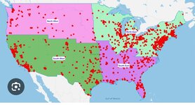
I’m trying to create 2 layers on one map of the uk. The first layer are thematic shapes of post sectors (first 5 characters of postcodes) colour coded by population and the second are points of 200 addresses with a value that I want to be shown as points with varied sizes based on their value. Does anyone know if this is possible in excel (similar to the below) If not are there any adding that are free. I’ve tried ArcGis but it won’t install and PowerBI seems to only show one layer at a time.
Thanks


